WORLD MAP
2010
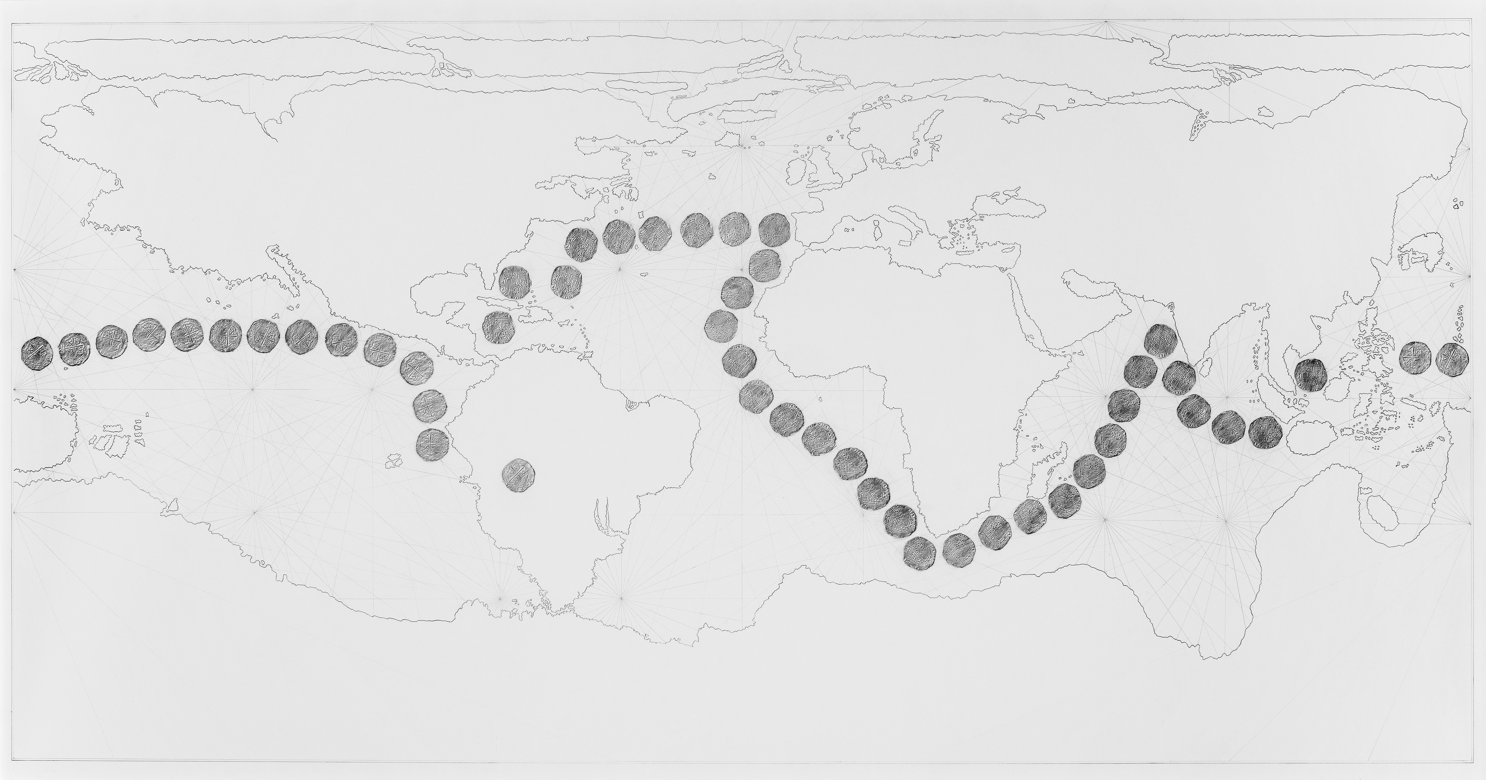
pencil drawing and frottages of historic silver coin on paper, 184 × 100 cm
WORLD MAP was conceived for the exhibition The Potosí Principle. The focus of the exhibition is the city of Potosí in the Bolivian highlands, founded to exploit the rich silver deposits of the Cerro Rico (rich mountain), that was to be the basis for the first ‘world currency’ — the Spanish silver coin of eight real. The history of Potosí thus marks the beginning of the global age. At the same time it is the history of the colonial exploitation of the indigenous people who were forced to work in the silver mines. This history is understood as a principle that is still repeating itself today.
With the WORLD MAP I want to depict the correlation between seafaring and cartography on the one hand and constant trade relations between Europe, Asia, the Americas and Africa with the silver peso as first ‘world currency’ on the other. The work is a 1:1 reproduction of a world map printed in 1600 by Arnoldo di Arnoldi in Siena. It is one of the very first world maps more or less matching the image of the earth we still have today. The model for di Arnoldi was a world map published by the Dutch cartographer Petrus Plancius in 1592. My reproduction of the map limits itself to the coastlines as they were known at the time and the grid of rhumb lines covering the oceans on the map.
Additionally the map shows frottages of a historical silver coin minted between 1586 and 1591 in Potosí — making the coin a contemporary of the world map. Lined up one next to the other, the frottages mark the main sea routes on which the silver from Potosí was travelling in an easterly and westerly direction around the globe.
